A new free online wildfire risk assessment tool calculates risk and displays a wildfire risk map for any home in the U.S.. It also calculates flood risk and provides the same information for floods and flooding as well. With more areas subject to climate change wildfires (California, New Mexico, Colorado, and more) and the devastating effects of wildfires, the manmade causes of wildfires are becoming more apparent. These risk factors are all taken into account by this new online wildfire risk assessment tool being provided free by the First Street Foundation.
While some people may balk at the idea that anybody can plug in anybody else’s home address and determine at how great a risk from wildfire and flooding is that address (think potential home buyers), or that insurance companies may be able to use the tool to raise the premium for or even deny coverage, this is important information for any home owner, and future home buyer, to have. And besides, insurance companies already have this information about your home, shouldn’t you too?
Speaking of home owners and potential home buyers, the wildfire risk assessment tool is intended for residential (not commercial) use only, and only provides wildfire risk assessment and flood risk assessment for residences. First Street Foundation does offer a version for commercial buildings (Risk Factor Pro), for which they charge.
The First Street Foundation’s tagline is “Defining America’s Climate Risk”, and that is exactly what they do. As they explain, they are a non-profit research group “dedicated to quantifying and communicating those risks by incorporating world class modeling techniques and analysis with the most up to date science available in order to simply, and effectively, inform Americans of their risk today and into the future from all environmental changes.”
In a statement this week, First Street shared the shocking statistics that more than 30 million homes in the U.S. face some risk of wildfire over the next 30 years, and that “Nationwide, the report finds nearly 20 million properties face ‘Moderate’ risk, (up to a 6% chance of experiencing a wildfire over 30 years); 6 million properties face ‘Major’ risk (up to 14% risk over 30 years); nearly 3 million face ‘Severe’ risk (up to 26% over 30 years); and approximately 1.5 million face ‘Extreme’ risk (greater than 26% risk over 30 years). Over 49 million properties face less than 1% chance of experiencing a wildfire over a 30-year period, or ‘Minor’ risk in the model.”
The Internet Patrol is completely free, and reader-supported. Your tips via CashApp, Venmo, or Paypal are appreciated! Receipts will come from ISIPP.
CashApp us

Venmo us

Paypal us

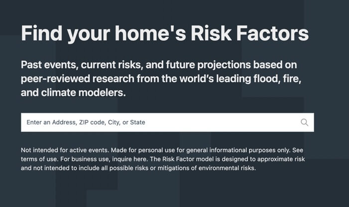
Using the Wildfire Risk Assessment Tool
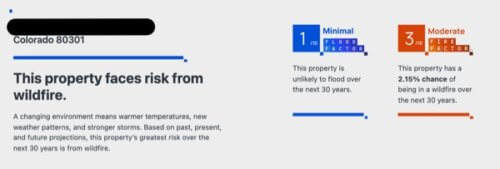
It’s really easy to use the First Street flood and wildfire risk assessment tool. You just plug in an address, and hit ‘submit’, and the tool instantly tells you how at risk your property is for both flood and wildfire.
You can find First Street Foundation’s free residential flood and wildfire risk assessment tool at RiskFactor.com.
The Internet Patrol is completely free, and reader-supported. Your tips via CashApp, Venmo, or Paypal are appreciated! Receipts will come from ISIPP.
CashApp us
Venmo us
Paypal us